Republic of Lebanon
#Date#


Three Geopackages have been developed to provide a high quality data set that can be utilized by all parties involved in the Management, Exploration and Development of hydrocarbons in Lebanon.
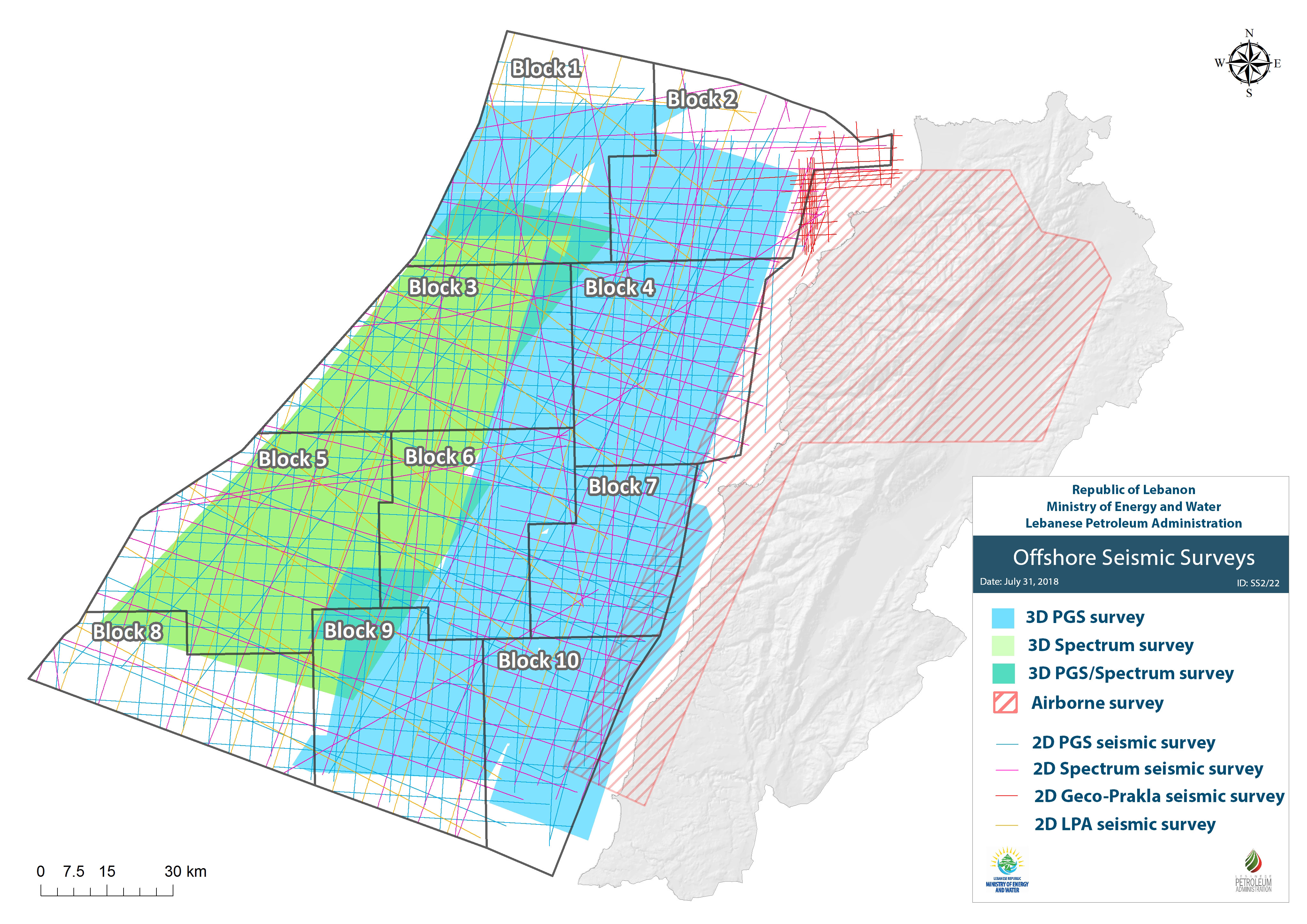
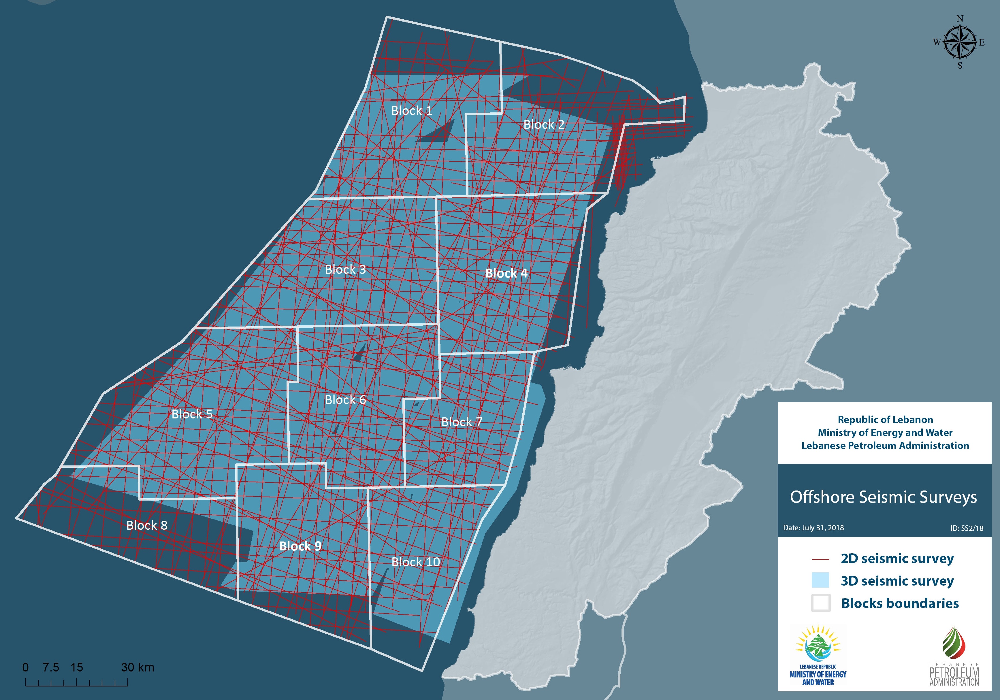
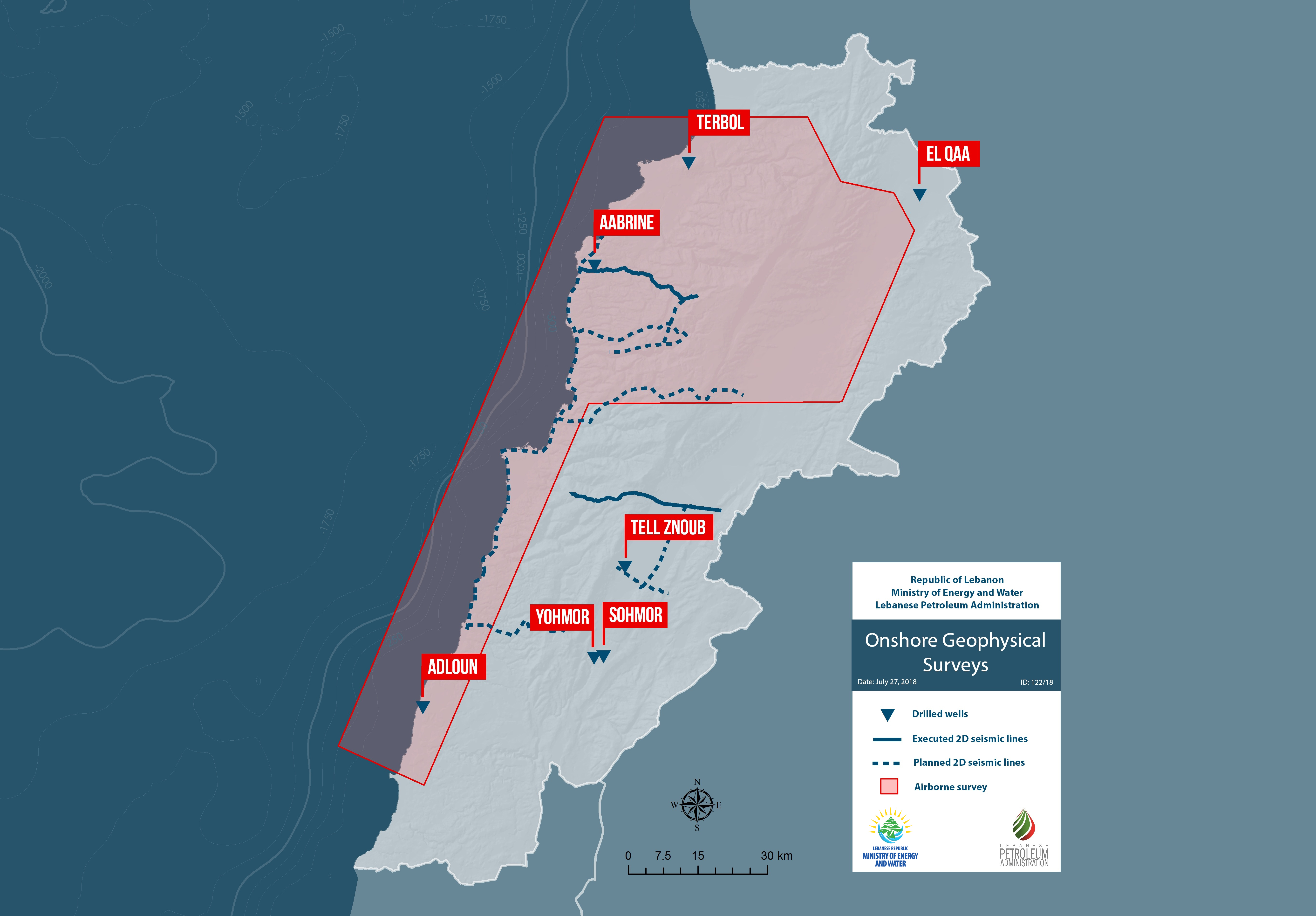
The Framework GeoPackage is available to IOCs interested in Lebanon’s offshore licensing round and can be accessed after accepting the terms of the License Agreement. There is no license fee to use the Framework GeoPackage. The Framework GeoPackage contains basic geographic information, seismic navigation, seismic examples, well locations, well summary sheets, surface geology and cross sections. It provides a useful starting point. Note that the framework GIS had been already utilized within the initial environmental impact assessment study that was recently completed.
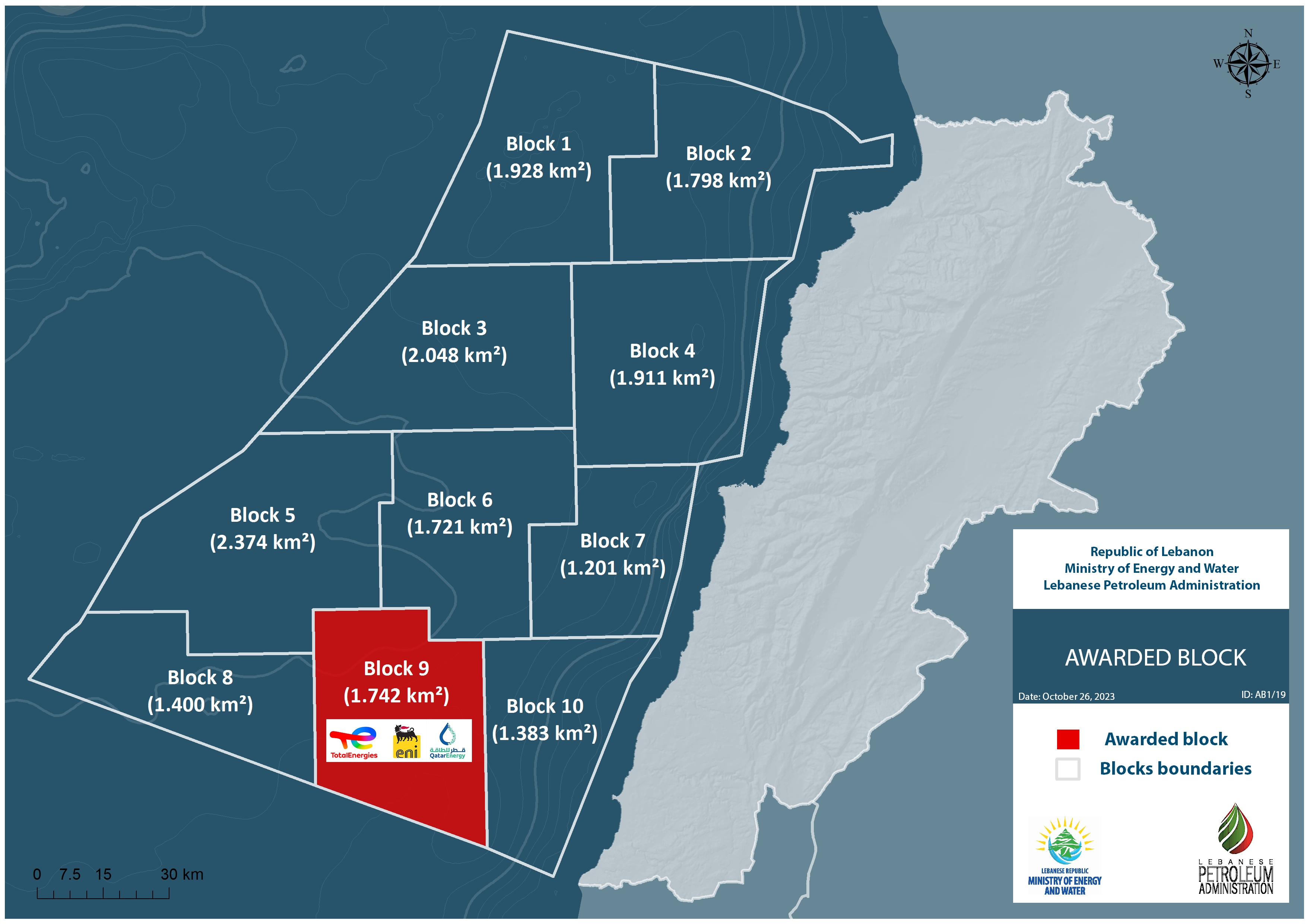
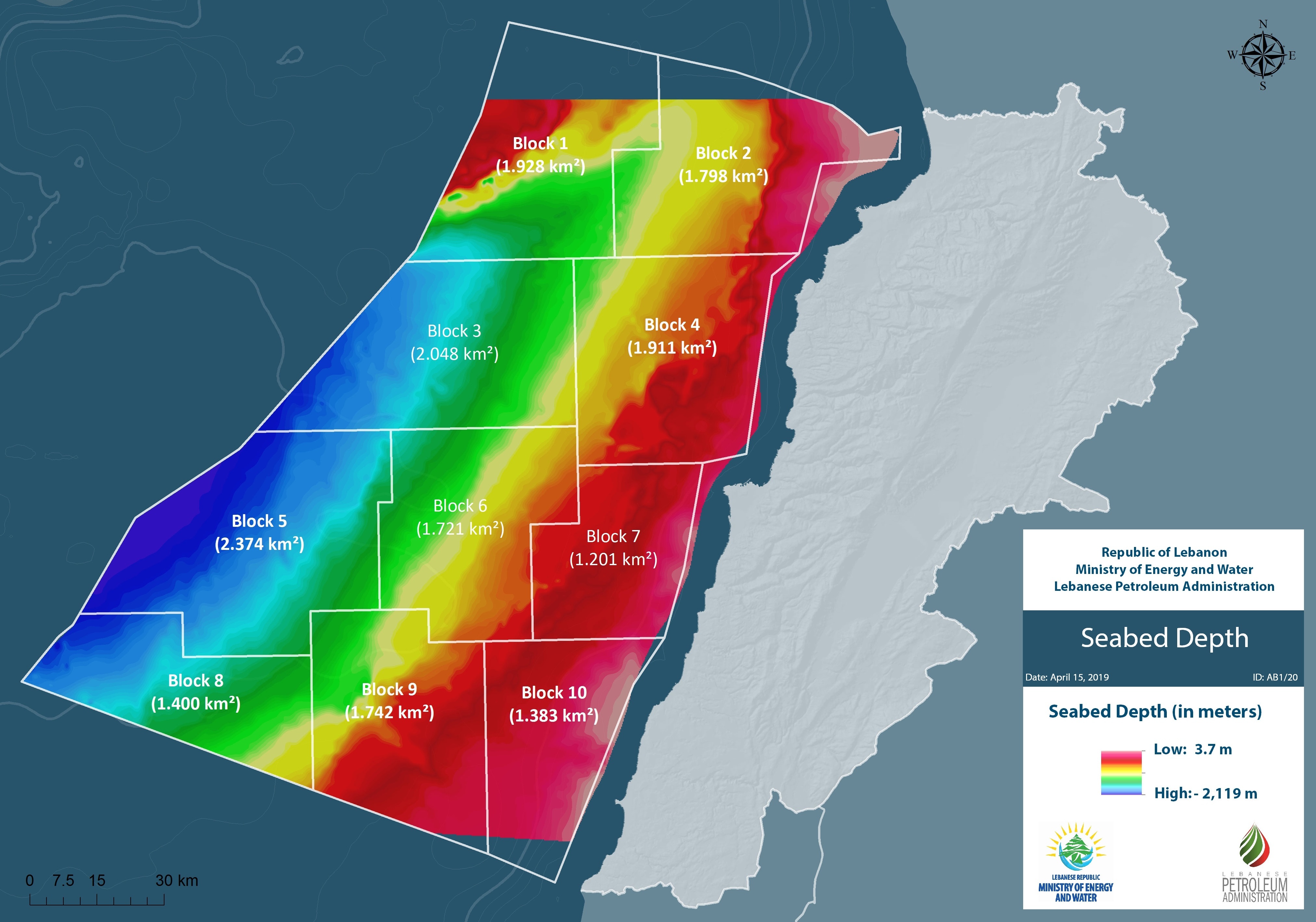
This version is included in the bidding documents (bid package) for the Second Offshore Licensing Round and given only to prequalified companies on the opening of the second round. It contains details of the contract areas on offer and representative seismic images through them in addition to all the information contained within the Framework GeoPackage.
The Data under the Enhanced Digital Atlas geopackage will be provided to Individual Companies by the Petroleum Administration upon receipt of the Retrieval Fee. It contains enhanced geo-scientific information including Grids of key horizons, Digital Well data, Field Sample analysis, Basin Modelling results, Gravity & Magnetics grids.
The GeoPackages are provided in ArcGIS format and can be utilised using free ArcReader software (supplied)
or a full Arc (ESRI) license. For more details please see presentation.
In order to obtain your copy of the Framework Geopackage, please complete this license agreement and then send it by email to datacenter@lpa.gov.lb.
To access the web maps please click here