Republic of Lebanon
#Date#


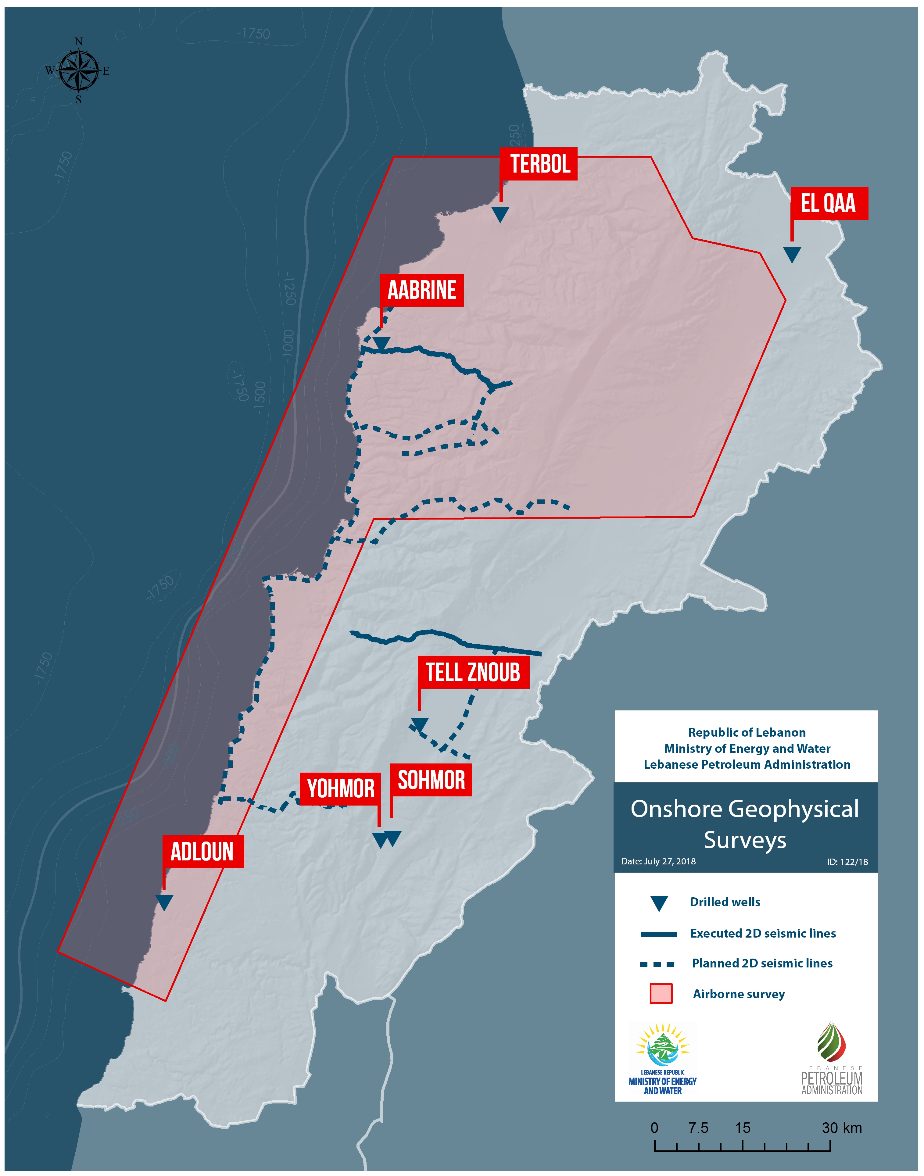
Seven wells have been drilled onshore between 1947 and 1967. Bitumen and gas shows had been observed. Spectrum performed 70.3 km of onshore 2D seismic surveys in 2013.
An airborne geophysical acquisition surveys have been undertaken in 2014. The survey covered approximately 6000 km2 of which 2000 km2 covered the coast of Lebanon and 4000 km2 onshore.
The airborne acquisition surveys aimed to connect the onshore geologic and geophysical data to the offshore data. This involved incorporating onshore and offshore seismic data in the interpretation and integration of the transition zone along the coast of Lebanon which allowed for vital insight into understanding the geology of Lebanon.
Further geophysical surveys will be performed in order to assess the hydrocarbon prospectivity onshore. 2D seismic acquisition programs, up to 500 linear km, will be performed with the objective of linking the offshore to the onshore in order to better understand the geology in the vicinity of the drilled wells onshore
In mid-2015, an interpretation study was performed on the data acquired from the airborne geophysical survey that covered 6000 km2, of which 2000 km2 covered the coast of Lebanon and 4000 km2 onshore.
The data interpreted supports the presence of significant potential for hydrocarbons discovery, and identified six areas of interest onshore and three areas of interest on the margin area. Furthermore, a dual seismic/gravity and magnetic interpretation was performed along parts of the 2D lines acquired by Spectrum that intersects with the gravity survey.
Poor seismic coverage and imaging quality on the margin had affected previous petroleum assessments, specifically in terms of risk assessment. The airborne geophysical and magnetic field data reduced uncertainties associated with risk assessment that have been calculated in previous studies. The data supported the presence of significant potential for discovery of hydrocarbons in Lebanon in the Triassic. Triassic and Paleozoic thermal analysis indicated wet gas transitioning to dry gas probable with some liquids possible. The study looks at the Triassic Reservoir only. The goals of the static (in-place volumes) calculations and uncertainty study are to determine volumes of gas in place.